
File:Biomes v6 2.png: Difference between revisions
>Wuzzy m ("heat only") |
(No difference)
|
Revision as of 20:59, 11 March 2020
This chart shows the distribution of biomes in the v6 mapgen, when 2 biomes (Temperate, Desert) are used. The desert biome has been available since 0.4.0. This configuration is used when the v6 mapgen flags “jungles” and “snowbiomes” are disabled.
In the v6 mapgen, each X,Z coordinate has a hidden heat and humidity value that is usually between -1.0 and 1.0. In this chart, the biomes are determined by heat only. This chart does not take the “biome blending” feature into account.
mgv6_freq_desert is a setting that specifies the minimum heat value for deserts to occur. The chart marks the default value of 0.45.
See also
- Temperate, Desert, Jungle, Tundra, Taiga: File:Biomes_v6.png
- Temperate, Desert, Jungle: File:Biomes_v6_3.png
File history
Click on a date/time to view the file as it appeared at that time.
| Date/Time | Thumbnail | Dimensions | User | Comment | |
|---|---|---|---|---|---|
| current | 18:34, 31 July 2023 | 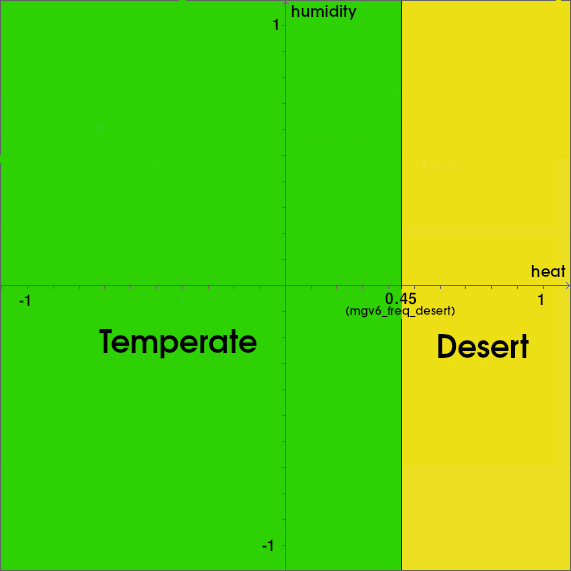 | 571 × 571 (14 KB) | Maintenance script (talk | contribs) | == Summary == Importing file |
You cannot overwrite this file.
File usage
The following page uses this file:
- File:V6 2biomes.png (file redirect)
